|
Listen To Article
|
Located in the southwest of Switzerland, and bordering France to the west and Italy to the south, the canton of Valais is notable for its variety. For starters, it is one of only three of the nation’s 26 cantons that is bilingual, with French and German as its official languages. The scenery equally reflects that sense of diversity, with grand mountain ranges that receive plenty of rain and snow — including the iconic, pyramid-shaped peak of the Matterhorn — and dry valleys along the central Rhône that produce wine. What is common throughout the canton is the vast array of options for those that enjoy being outdoors.
Hiking at Aletsch Glacier
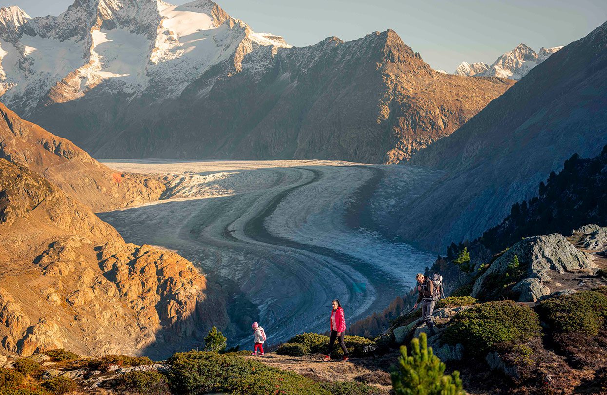
Hiking is immensely rewarding in Valais, with a number of breathtaking routes across the region, including walks around Zermatt that come with heart-stopping vistas of meadows and the Matterhorn. The Aletsch Arena, a ski resort on the Aletsch Glacier, a UNESCO World Heritage Site, is a walk that begins with a ride up to Moosfluh viewpoint from the Gletscherbahn Moosfluh valley station. From here, the ridge leads west via Hohfluh to Villa Cassel, an imposing former hotel that is now used as a conservation centre.
Continuing on the walk, travellers will encounter five stations that demystify the glacial region, with informative, acoustic and playful presentations on the themes of Wilderness and Civilisation, the Nature Reserve and Alpine Farming, Water Shortage and Reservoirs, the Gratzug and Poor Souls (based on a local folk legend), and Nature Conservation and Tourism. A number of stunning lookout points elevate this easy trail into an extraordinary experience.

Aletsch Glacier, a UNESCO World Heritage Site, image credit Switzerland Tourism
Glacier walk at Laengfluh Glacier, Saas-Fee
Another thrilling adventure awaits on the glacier and Marmot Trail at Saas-Fee, an Alpine village in the Saas valley near the border with Italy. Here, the furry marmots wander and play in the areas of the mountain called Spieldboden and Stafelwald. During the sunny summer months, they enjoy being fed peanuts and carrots, tasty and deserved treats after a six-month winter hibernation in their caves; bags of peanuts are sold at the Saas-Fee Tourist Office and in the Spielboden restaurant.
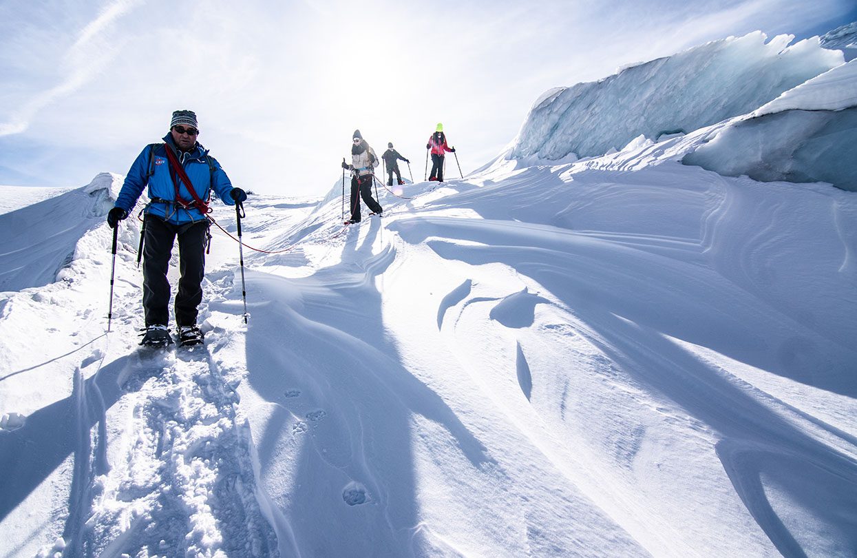
The period from early June to late September is also the best time for a tour over the Fee Glacier. Incredible describes the walk on ridges and slopes of ice that come with views of dense, verdant forests in the valley below. The trip begins with crampons, poles and a climbing harness at Spielboden mountain station, and the ascent to the peak involves all adventurers to be secured to the mountain guide’s rope.
Crossing mammoth séracs (columns of glacial ice) and crevasses, travellers will wind their way up to the highest point on the glacial plateau, the Panoramaplatz, where the views are as far-reaching as the name suggests. The easy descent leads to the Längfluh station, to a sun terrace where guests get the chance to unwind after their glacial getaway. This trip requires no prior ice-walking experience and minimal fitness, but the rewards are exceptional.

Saas-Fee Serac tour, image credit Switzerland Tourism
Thermal canyon walk in the Dala Gorge
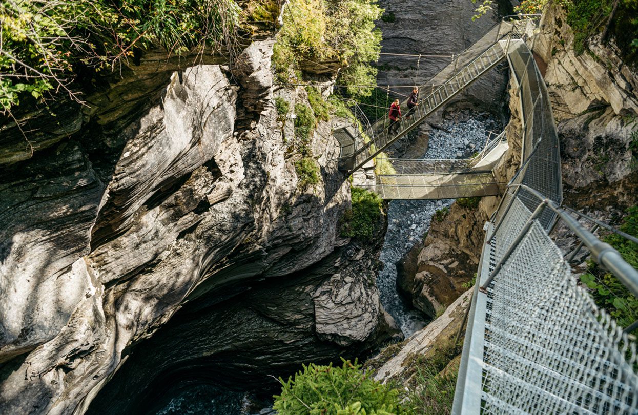
Different terrain presents itself during the thermal canyon walk in Dala Gorge, a theme trail that devotes its attention to Leukerbad’s famous mineral water and also a spectacular walkway that hugs the sinuous lines of the Dala gorge, site of the hot springs. The themed route kicks off in the village centre, crossing Leukerbad resort with information panels highlighting the various hot springs in the resort, the medicinal properties of the thermal water, and its importance for the local economy.

Spectacular walkway that hugs the sinuous lines of the Dala gorge, image credit Switzerland Tourism
The theme trail transforms into a canyon walk at the entrance to the Dala Gorge. This Instagram-worthy walkway, first opened in 2004, is a secured steel structure that reaches deep into the heart of the gorge, with the thermal springs bubbling up in the river bed below. Look for rust-brown streaks on the cracks and fissures of the canyon walls and by the river’s edge below, indicators of the high iron content of the mineral-laden waters.
The walkway itself is 600 metres long, leads through the gorge to a 35-metre waterfall, and is wheelchair accessible; those that want to see the source of the waterfall can climb up stairs to the crystal-clear pool above. To extend the hike, the ravine returns to Leukerbad via the northern side of the gorge and the hamlet of Buljes, with the option to continue on the lower part of the village of Leukerbad, a total length of 2.8 kilometres, that takes about 90 minutes. A visit here can be book-ended with a soak at the public baths at Leukerbad, warmed to 51 Celsius and surrounded by mountains, and lunch at the Panorama Restaurant at Gemmi Pass.
Nature trails along ‘bisses’ at Nendaz and Veysonnaz
Here in the Valais, a network of historic mountain water irrigation channels spreads across the region, some dating to the 13th century. Known as bisses, they form a web of beautiful waterside walks that weave through the countryside, sometimes high above valleys, sometimes through charming alpine villages, and sometimes affording the chance to see Alphorn blowing demonstrations.
Nendaz and Veysonnaz are two bases for wandering and getting truly up close to the gorgeous Swiss countryside on these bisses. The walks are easy, suitable for children and adults, and there are eight in the area, delivering almost 100 kilometres of footpaths. Set between 700 and 2,300 metres above sea level, they are simple, low-impact summer hikes blessed with clean alpine air.
Bisse de Salins, Bisse de Vex is a pretty loop along two bisses that offers magnificent views over the Nendaz valley and the chance to discover the lesser-known village of Clèbes. Coming in a shade under 10 kilometres, the walk takes a little more than three hours, with variation in altitude of 660 metres. A more rigorous proposition is the Bisse de Chervé, 11 kilometres in length with a change in altitude of 293 metres, and estimated time of completion of just over three hours.
A magnificent high-altitude walk that offers inspiring views of the Cleuson dam, it is accessed from the top of the Combatseline chairlift. This walk is the highest, most alpine of all bisses walks, with the entire path above 2,200 metres and filled with grandeur throughout. The turquoise waters of the Cleuson dam come into view about 45 minutes into the walk, and the same narrow path leads to a stunning view over the dam lake, gradually opening to a wider path at a location called La Gouille. From here, hikers have two options — to climb up to St-Laurent mountain cabin or descend along a track that skirts the lake before reaching the dam wall, and down further to the village of Siviez. Visitors have the opportunity to take a guided tour of the dam on Fridays during the summer, an eye-opening window to this engineering marvel.
Explore the historic Simplon Pass
The Simplon Pass connects Brig and Valais with Domodossola in Northern Italy, and has a lively past. It was used as early as the Stone Age, but because of its narrow Gondo Gorge, considered impassable by civic architects, it was a popular route for mainly smugglers and mercenaries. But the visionary Brig merchant prince Kaspak Jodok von Stockalper began to use the pass in the middle 17th century to transport salt from the Mediterranean on the backs of mules, making him a fortune in the process. (That wealth is evident in the huge, baroque Stockalper Palace in Brig). Vehicular traffic started there in the time of Napoleon, but it wasn’t until 1906 that rail arrived, with the opening of a tunnel through the Simplon, 19 kilometres long and, until 1982, the longest tunnel in the world.
The pass is truly beautiful, with roads that take visitors over the long curves of the mountains. Halfway up, the Ganter Bridge traverses the Ganter Valley, and the bold, modern, sleek, multi-span reinforced concrete bridge has a setting that is almost otherworldly, high above the valley floor and flanked by mountains.
At 2,005 meters, on the summit of the pass, stands the Hospiz of the Bernardine monks, a simple rectangular building in a spectacular setting with a panorama of the Bernese Alps. On the southern side of the pass, the road towards Italy enters Simplon Village, where the typical stone plate roofs on the buildings recall nearby Italy, as does the village square. The road continues via galleries and tunnels through the narrow Gondo Gorge, granite walls along its side, and the village of Gondo houses gold mines open for visits.
The Stockalper Trail, the 35-kilometre long, fully preserved mule passage that dates from the 17th century holds great cultural significance, and today is a bonafide hiking route from Brig over the Simplon Pass to Gondo. It can be covered in three days, with overnight stays along the Simplon Pass and in Simplon Village, where the renovated Alte Gasthof (or Old Inn) has two museums dedicated to the Simplon’s cultural landscape. And at the starting point, in Brig, the stately Stockalper Castle offers guests guided tours that access many parts of the magnificent centuries-old mansion, interiors that are as alluring and unique as the region’s remarkable nature. ◼
Subscribe to the latest edition now by clicking here.
© This article was first published online in July 2022 – World Travel Magazine.

